Hagood Avenue Corridor Study
The Hagood Avenue area is facing many of the major issues of Charleston today; compound flooding risk from tides and stormwater, housing equity, and development pressures. Much has happened and much is planned in the area; this is an opportunity to get all projects on the same page, working towards common goals. A comprehensive approach must be taken, identifying opportunities and a critical path forward.
Photos: The intersection of Hagood Ave and Line Street. April 2023. 6.3ft tide.
100 Years of Changing Landscape
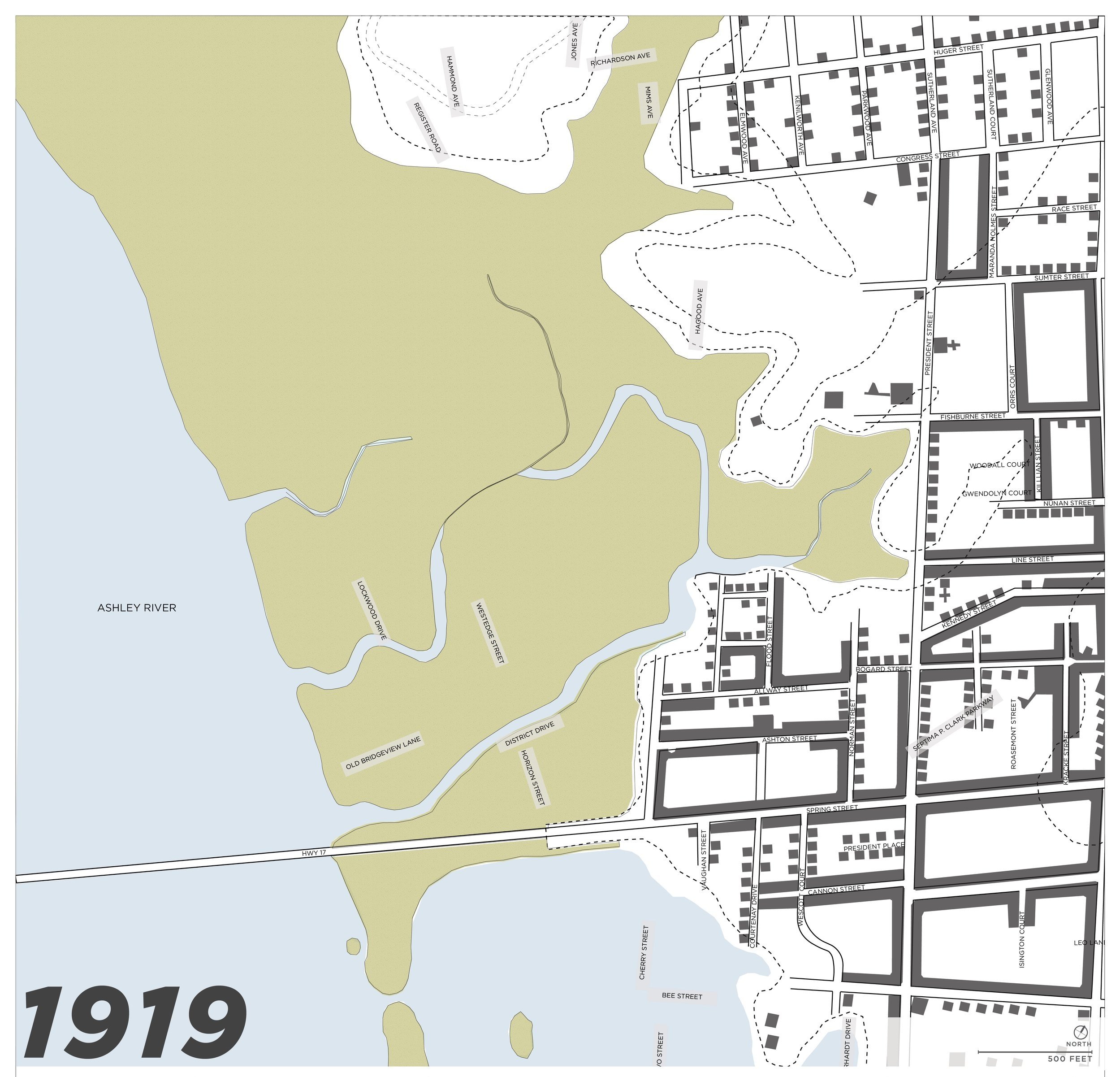
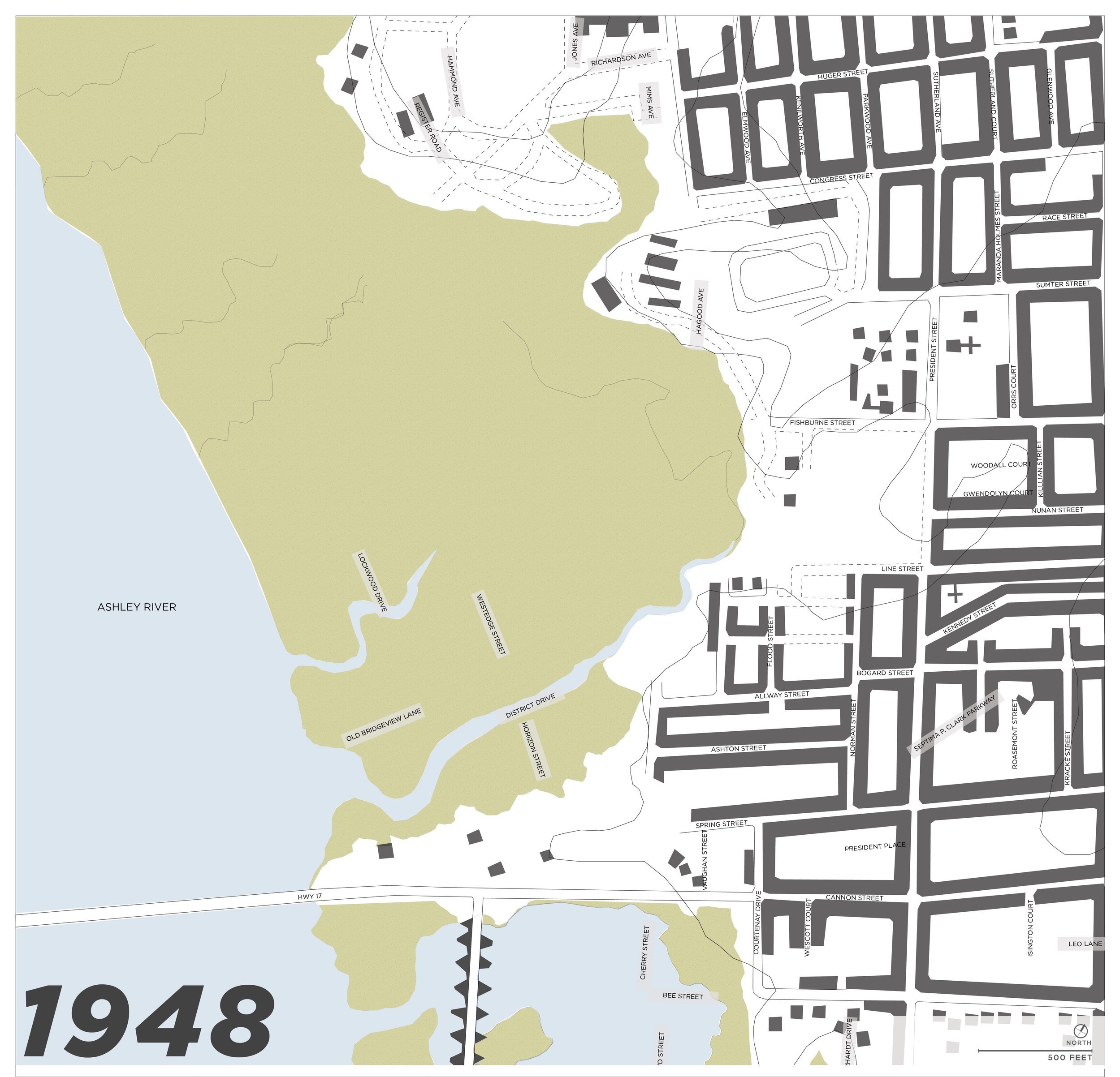
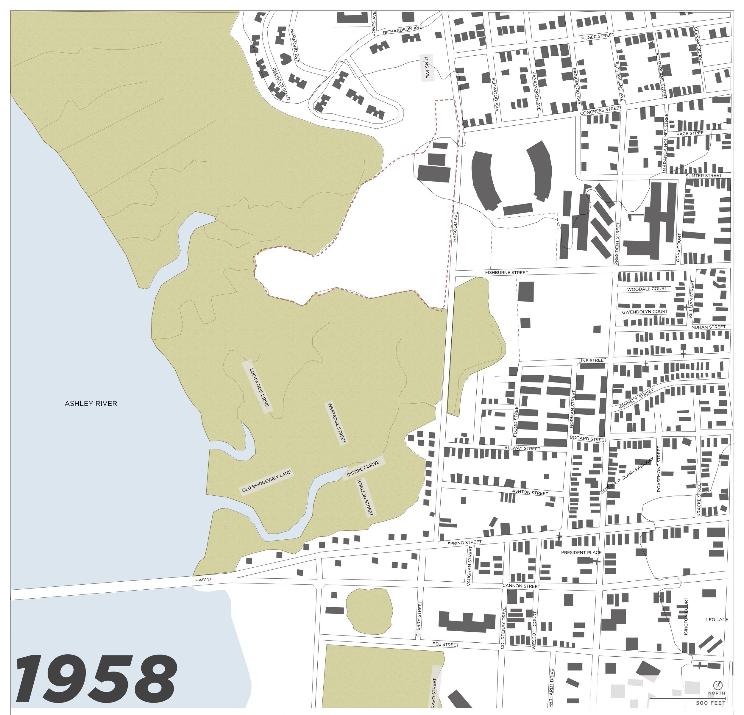
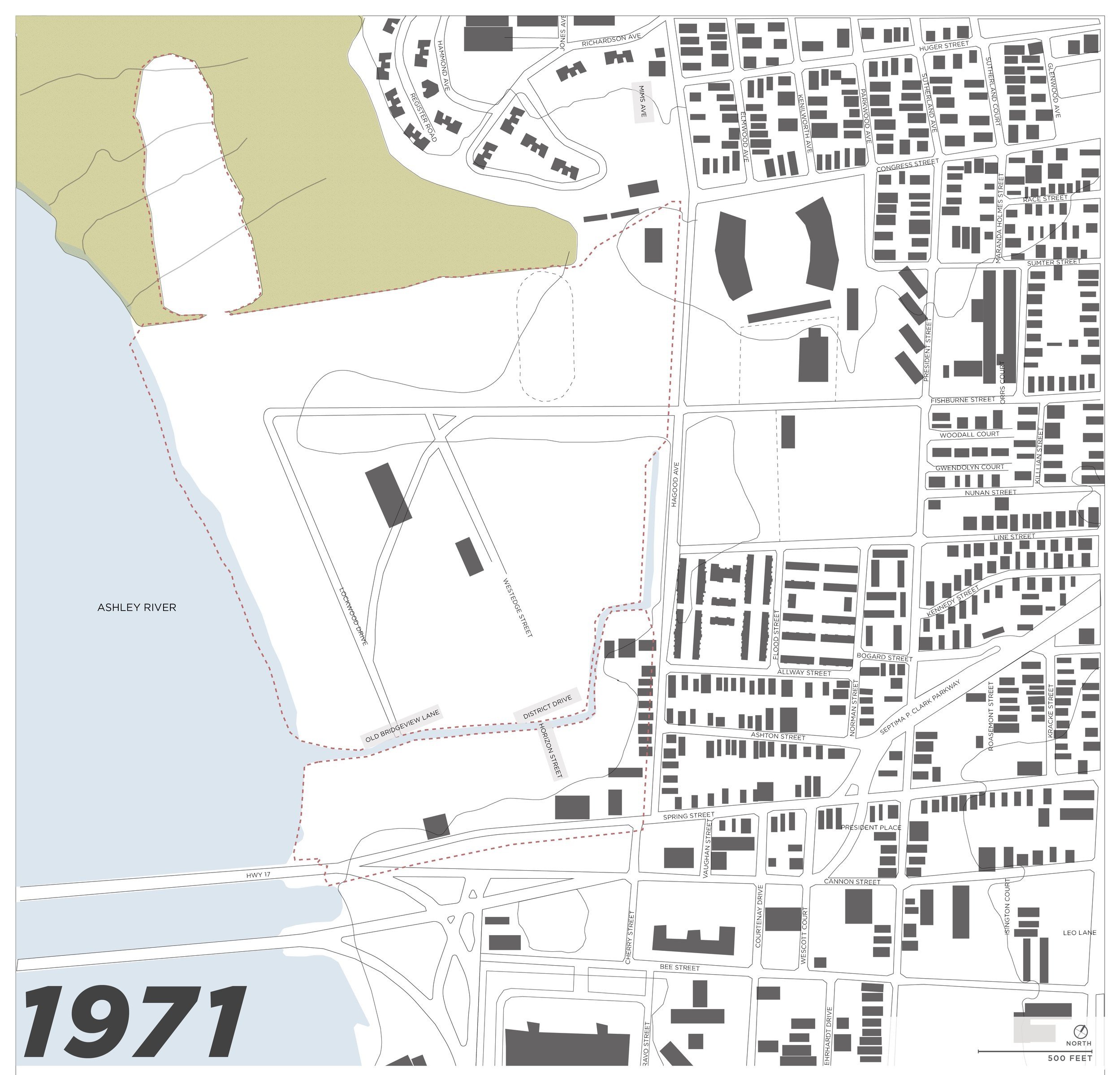
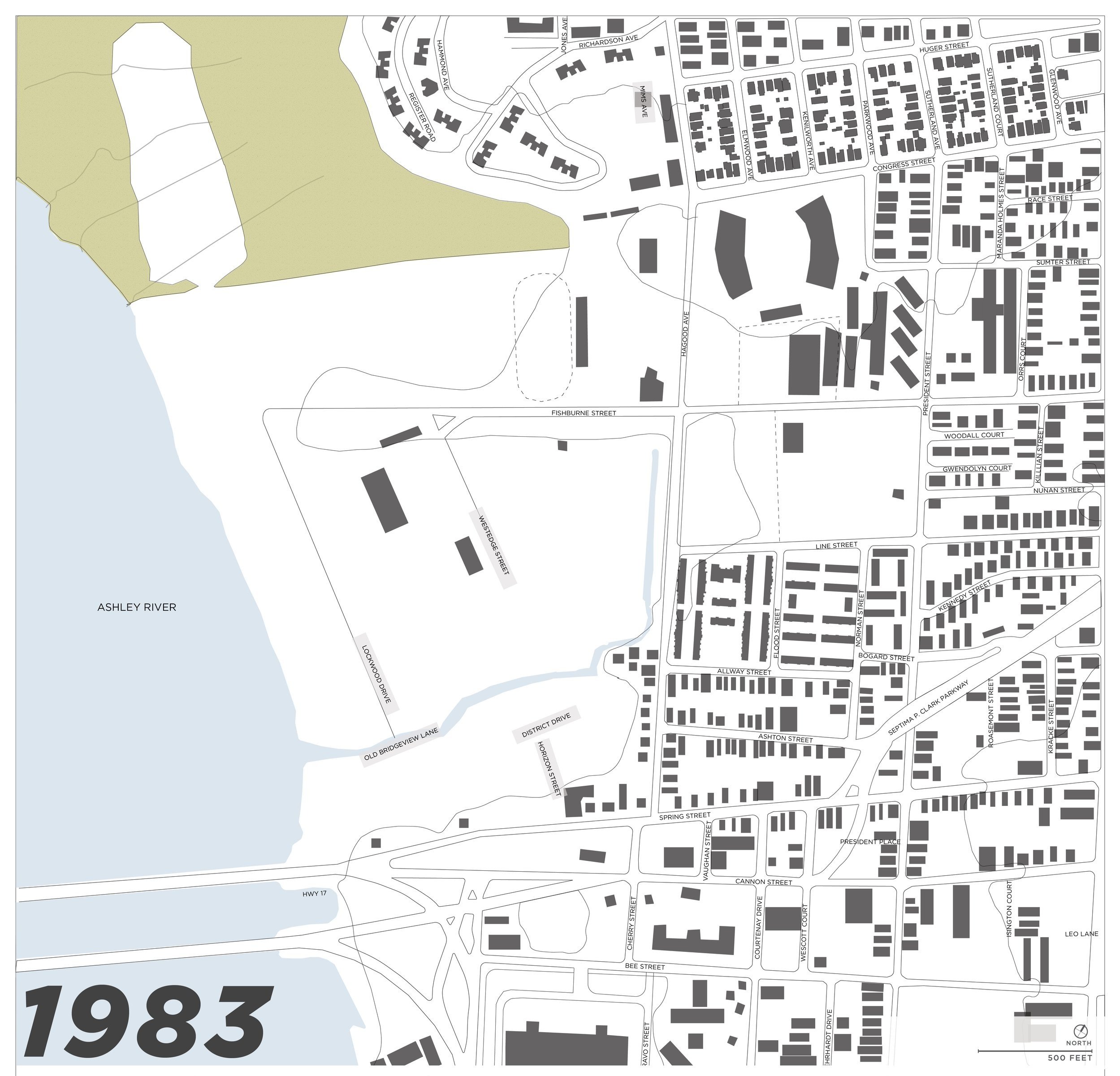
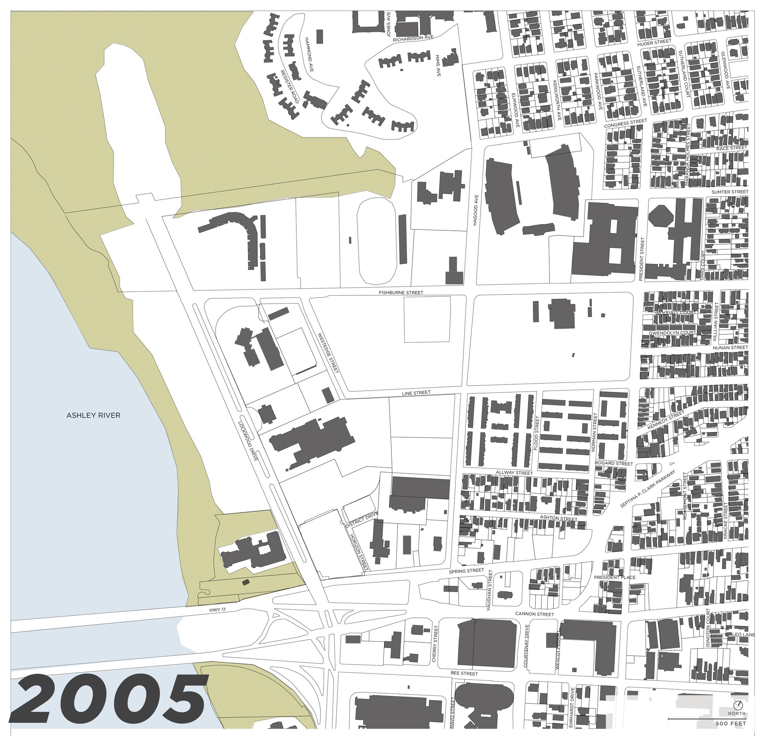
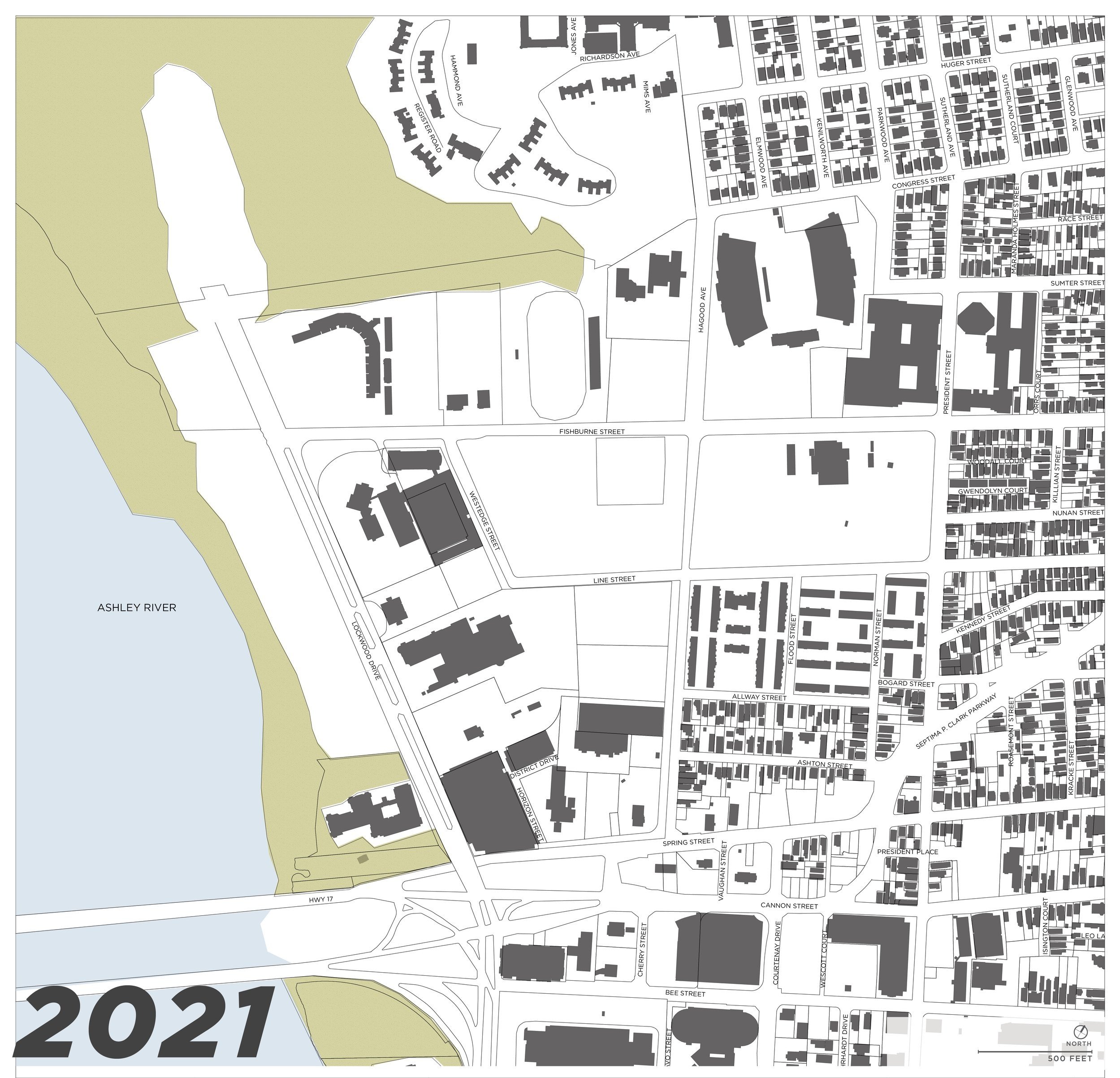
Today’s coastline at Brittlebank Park is approximately 1/2 mile from the historic coastline which was on the eastern side of Hagood Avenue. The location of Gadsden Creek and other tidal inlets have moved over time, and the marsh became a landfill. When the landfill was closed, three feet of dirt was placed as a cap to cover and seal about fifteen feet of waste. Overtime, more earth has accumulated and eroded, adding an additional three feet or more of dirt in some places and wearing the cap down to only a few inches near Gadsden Creek.
Below: Map series documenting the changing landscape and building pattern over the last century. Major impacts to the geography include the land-filling and the addition of Septima P. Clark Parkway through a historically black neighborhood.
What type of corridor, neighborhood, do we want to see?
The driving force behind this project, the reason design is valuable, is to define and create a desirable neighborhood street that is functional, dry, and supports the neighborhood. Hagood Avenue has immense potential to be an active corridor with stormwater storage, vibrant tree canopy, and to provide a critical connection to and from the west side of the peninsula. With building setbacks, much of the area stormwater needs can be located in low areas next to Hagood Avenue.
This section drawing illustrates a potential future for Hagood Avenue; the road is elevated, has been reduced to two lanes for vehicles, includes bike lanes, and significantly wider sidewalks, street trees, and increased stormwater storage.


